|
| Munroe and Russell Homesteads |
|
| On the usual Biblical seven-years-of-servitude schedule for “redemptioners,” 8GGF William “The
Immigrant” Munroe would have been a free man, eligible to own property, by 1659.
The records indicate that he became in 1660 the proprietor of a land grant up against the Woburn line. He named his new spread “Scotland,” after his Old World home. |
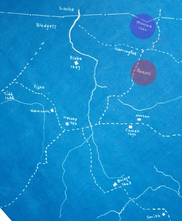
|
| The dashed lines on this map represent roads or paths, not (necessarily) property boundaries. The (sorta) east-west Woburn Road, wiggly and more or less diagonal here, lay between “Scotland” and the Russell homestead, as did the old road north (leftward) to Billerica and south to “The Rocks,” (Arlington Heights), which followed very roughly the course of present Lowell Street, Laconia Street, and the Middlesex Turnpike. |
|
Back a Page (Lexington, Early Settlers) |
This
Section: NewTowne |
Page Index |
[002SettlerDetail.htm] Updated Jul 2020 |
Next Page (Lexington: Munroe and Russell Homesteads) |
Page NewTowne-29 |
| Welcome | Stories | Sections | Such a Life | People | Places | Site Search | Do You Know? |