|
| Watertown: Two Landing Locations |
|
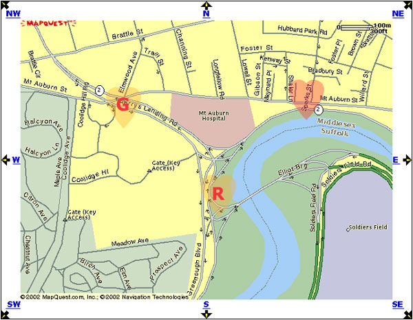
| In 1948, the Historical Society of Watertown erected this marker on the river bank, designating (R) as the location of Sir Richard’s Landing. It’s a lovely spot, in keeping with what one might expect. In 1930, however, the Massachusetts Tercentenary Commission had already put up this sign, a few hundred yards to the north and east of the river, claiming for this spot (G) the distinction of being Sir Richard’s Landing and also as the later Gerry’s Landing. Note also in this map the emphasis on Sparks Street, which was until 1754 the Watertown-Cambridge boundary. |
|
Back a Page (Map of Landings) |
This
Section: Watertown |
Page Index |
[RLMap.htm] Updated Jul 2020 |
Next Page (1948 marker) |
Page Watertown-6 |
| Welcome | Stories | Sections | Such a Life | People | Places | Site Search | Do You Know? |