|
| Nauvoo Streets |
|
|
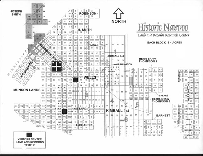
This is the map that they distribute these days at the Land and Records
Office (under LDS auspices) at Parley and Partridge. It shows mainly streets and
blocks from the Mormon era. Most of these streets, particularly those
toward the right, are gone now, casualties of a century and a half of
modern land use.
When you ask where your relatives used to live, the nice people at the Office will mark up a copy of this map and send you forth to discover what’s still there. Here's a compilation of the markings they gave us. And here’s the map from the Joseph Smith Historic Center (RLDS); it has a somewhat different emphasis. |
|
Back a Page (Our 36 in Nauvoo) |
This
Section: Nauvoo |
Page Index |
[NauvooMap.htm] Updated Jul 2020 |
Next Page (Marked map) |
Page Nauvoo-4 |
| Welcome | Stories | Sections | Such a Life | People | Places | Site Search | Do You Know? |