|
| Munroe and Russell Homesteads |
|
|
|
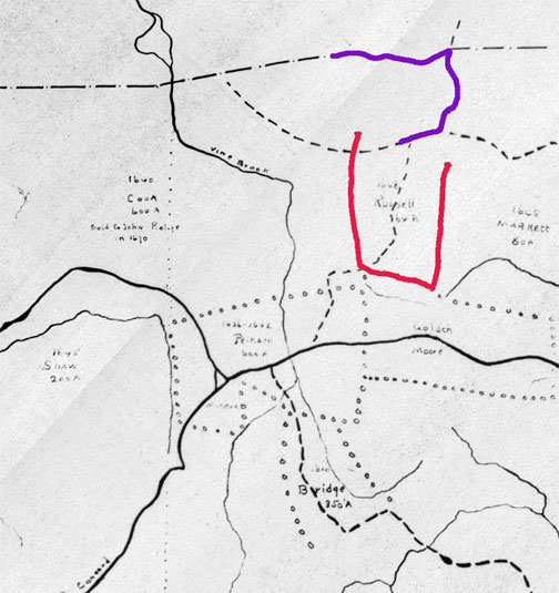
The Russell property (in red) is labeled “1648 Russell 64 A”. The neighboring land was as yet unallocated; twelve years later, it would become
William Munroe’s “Scotland.” The Russell boundary in that direction is therefore vague and incomplete.
The Munroe boundary (in purple) is conjectural (until I turn up better evidence), but it’s pretty clear that “” stopped at the Woburn line and, probably, at Woburn Road, as I’ve shown. Just how far it extended toward the north (left), I’ve as yet seen no evidence. |
|
Back a Page (Grants) |
This
Section: NewTowne |
Page Index |
[005GrantsDetail.htm] Updated Jul 2020 |
Next Page (Topographic map) |
Page NewTowne-32 |
| Welcome | Stories | Sections | Such a Life | People | Places | Site Search | Do You Know? |